Piantarella Beach (Bonifacio): tips and photos
A narrow strip of sand beside a shallow lagoon, facing Piana island: people come for the wind, the sailing, and to set off on foot to the two Sperone beaches.
We may earn a commission when you book through our partner links, at no extra cost to you. Updated 1 November 2026
Why go to Piantarella
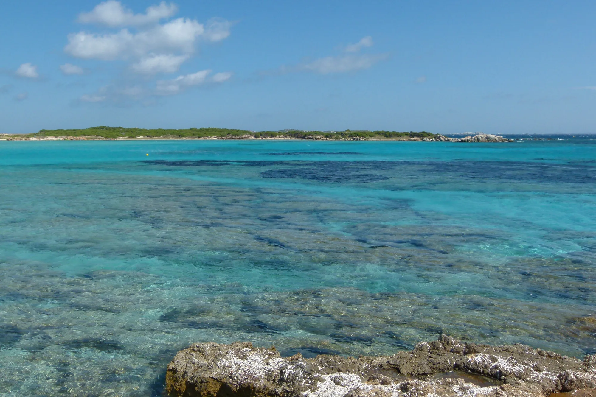
Piantarella looks nothing like the postcard beaches of the south. It is a narrow strip of sand, about 200 m long, set between a pond and a turquoise lagoon where you can stand a long way out. Opposite, 500 m away, Piana island fills the horizon; beyond it begin the Bouches de Bonifacio (Strait of Bonifacio).
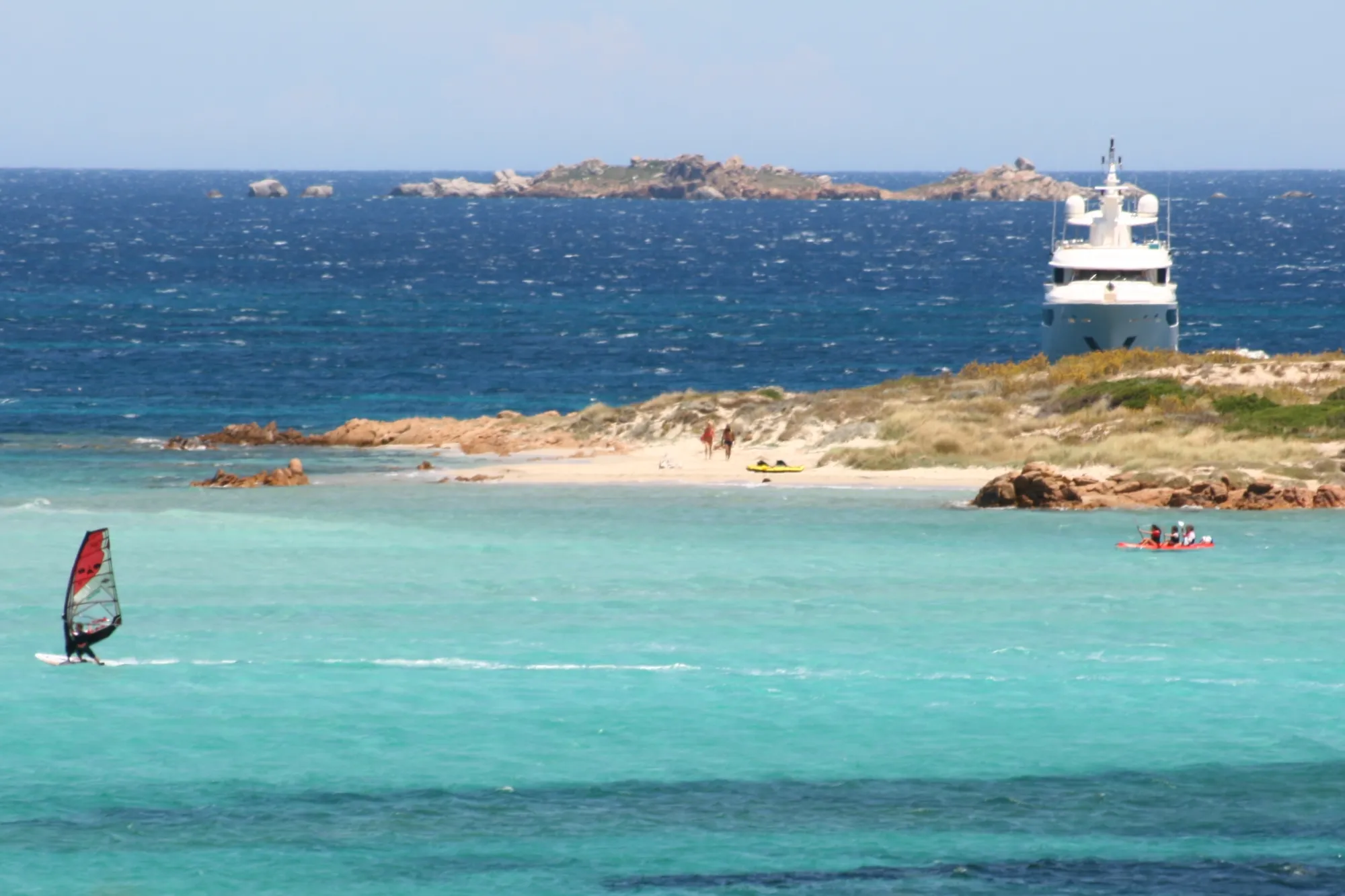
People come here for three reasons. First, the wind: the tourist office calls it “the sportiest beach in Bonifacio”. Then the sea, since the small harbour next door is a departure point for the Lavezzi. And finally the path: this is where you set off on foot for the two Sperone beaches. If all you want is white sand for the day, keep going and walk ten minutes further.
Type of beach: sand, water and swimming
The tourist office and the Agence du tourisme de la Corse (the Corsican tourist board) put it plainly: there is no white sand here. The sand is mixed with banks of Posidonia and seaweed, which can give off a smell in summer. They are a sign of a healthy environment, and removing them is forbidden.
In front of the beach, a shallow sandbank stretches towards Piana. The water is clear, and you can see the seagrass beds as dark patches. Recent averages (2023-2025) from the Open-Meteo Marine dataset give a sea temperature of 18 °C in May, rising to 26 °C in August and holding at 24 °C in September; in the lagoon, the water is often warmer in summer.
The water is rated excellent quality by the ARS (the regional health agency) for 2022-2025, and the test on 1 July 2026 was compliant. No lifeguard station is listed for 2026: the tourist office map shows supervised swimming only at Balistra. The frequent wind and the currents towards the island call for care.
The parts of the beach
As you arrive, you come first to the small harbour and its pontoons, with the sailing school on the left. You then have to cross a few rocks to reach the strip of sand, on the right. It runs along the Piantarella pond, a small lagoon where birds settle: the tourist office asks you not to disturb them.
To the south, the sand gives way to a rocky shore and low cliffs. The coastal path carries on to Petit Sperone beach, about ten minutes on foot from the car park, then to Grand Sperone beach, further along the same path.
Sailing, wind and Roman ruins
Piantarella is a windsurfing, wing foiling and kitesurfing spot, open to beginners and experienced riders alike. At the small harbour, the sailing school runs taster sessions; you can also hire a kayak or a paddleboard. A mask and snorkel are worth bringing for the lagoon, as long as you stay close to the shore. Boats leave the harbour for the Lavezzi islands, for half a day or a full day.
The water belongs to the Bouches de Bonifacio nature reserve, and the beach to the Natura 2000 site Plateau de Pertusato / Bonifacio et îles Lavezzi. On Piana island, where many birds nest, landing is strongly discouraged and forbidden from 15 December to 15 April. By boat, read the maritime prefecture’s orders and avoid dropping anchor on the seagrass beds.
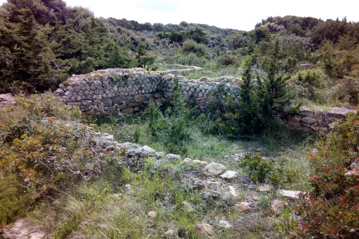
About a hundred metres south-west of the beach, dry-stone walls mark a Roman villa with warehouses and docks, occupied from the 1st to the 4th century and listed as a historic monument in 2007. The site is on private land: it cannot be visited.
When to go
In July and August, Piantarella draws a lot of people: come early in the morning or late in the day, especially as the car park is small. June and September give you warm water with fewer people. For windsports, check the forecast first: the wind makes the day.
How to get there
Piantarella is at the end of the road that heads east from Bonifacio, past the Sperone golf course. You need a car, then a few minutes on foot.
By car
From Bonifacio harbour, allow about a quarter of an hour (6.4 km, OSRM calculation, outside summer and without stops). Head towards Pertusato, then carry straight on along the D260 to the end of the road.
Parking
You park near the small harbour, past the golf course entrance on the right. Spaces are limited; the commune is building a pedestrian access and car parks in 2025 and 2026, and in the meantime parking along the road is tolerated (Agence du tourisme de la Corse). Things may have changed since: check with the Bonifacio tourist office.
From the car park to the sand
Facing the small harbour, the sailing school is on the left; the beach is on the right, beyond a few rocks. The sand starts 400 m from the car park, about 5 minutes on foot (OpenStreetMap walking route), a little more to reach its southern end.
Without a car
We found no bus route to Piantarella. For coaches to Bonifacio, see the timetables published by the tourist office.
Where the beach is
Good to know
Dogs
According to the 2026 tourist map from the Bonifacio tourist office, dogs are tolerated on a lead on the beaches of the Bouches de Bonifacio nature reserve. They are banned from the Lavezzi archipelago. Along the pond, keep your dog close: birds settle there.
Wheelchair users
The Agence du tourisme de la Corse and the tourist office state that Piantarella is not accessible to people with reduced mobility: you have to clamber over rocks between the harbour and the sand.
With children
The lagoon is shallow, and the tourist office listing mentions water sports for 6-12 year olds as well as 13-17 year olds. But the site is windy, and the currents can be strong between the beach and Piana island: keep children close to the shore. No lifeguard station is listed for 2026.
Naturism
No official text provides for naturism at Piantarella. For the beach rules, check with the commune of Bonifacio.
Eating
No official source mentions anywhere to eat. OpenStreetMap shows bars near the small harbour, recorded in 2024: check on the spot. Bring water and a picnic. The beach is smoke-free.
The beach in pictures
The Lavezzi by boat from Bonifacio
The trips below leave from Bonifacio harbour, a quarter of an hour by road. Those leaving from the small harbour at Piantarella are booked on the spot.
Prices and ratings checked on GetYourGuide in October 2026. We may earn a commission when you book through our partner links, at no extra cost to you.
Staying near the beach
The closest area to the beach in our Bonifacio guide: The Santa Manza road.
- Résidence Casarina 9.4/10 on Booking · Oct 2026Book
See 4 more places to stay Hide
We may earn a commission when you book through our partner links, at no extra cost to you.
Frequently asked questions
Where is Piantarella beach?
East of Bonifacio, at the end of the D260, about a quarter of an hour by road from the harbour. It faces Piana island, at the entrance to the Bouches de Bonifacio (Strait of Bonifacio).
Is there white sand at Piantarella?
No. The tourist office says so itself: you will find a narrow strip of sand and banks of Posidonia, which can smell in summer. For white sand, walk ten minutes or so to Petit Sperone.
Can you walk to Piana island?
A shallow sandbank leads towards the island, but landing there is strongly discouraged, and forbidden from 15 December to 15 April to protect nesting birds (Agence du tourisme de la Corse). Wind and currents can be strong between the beach and the island.
Can you go kitesurfing or windsurfing at Piantarella?
Yes: it is a well-known spot for windsurfing, wing foiling and kitesurfing, beginners included. There is a sailing school at the small harbour. Check the weather forecast before you go.
Can you visit the Roman ruins at Piantarella?
No. The remains of the Roman villa, listed as a historic monument in 2007, are on private land. The tourist office states that you cannot go near them.