Barcaggio Beach (Cap Corse): tips and photos
Nearly a kilometre of sand at the tip of Cap Corse, facing the Giraglia, between a protected dune and a lagoon.
We may earn a commission when you book through our partner links, at no extra cost to you. Updated 2 November 2026
Why go to Barcaggio beach
Barcaggio beach is also called Cala beach (A Cala): that is the name on maps and used by the Cap Corse tourist office. It stretches below the hamlet of Barcaggio, at the very end of the Cap Corse road. The hamlet and the car park are in the commune of Ersa, but the sand is in Rogliano.
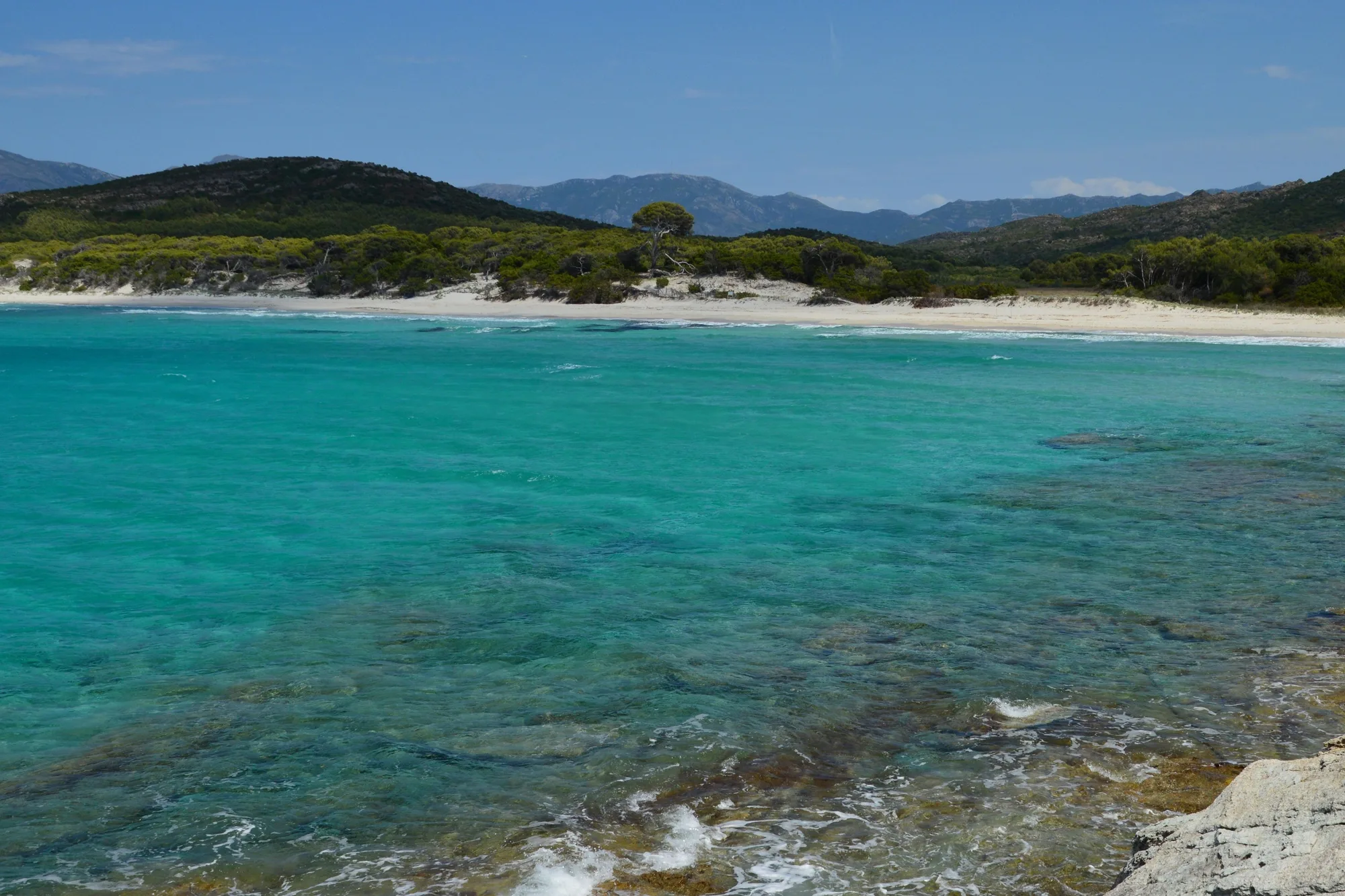
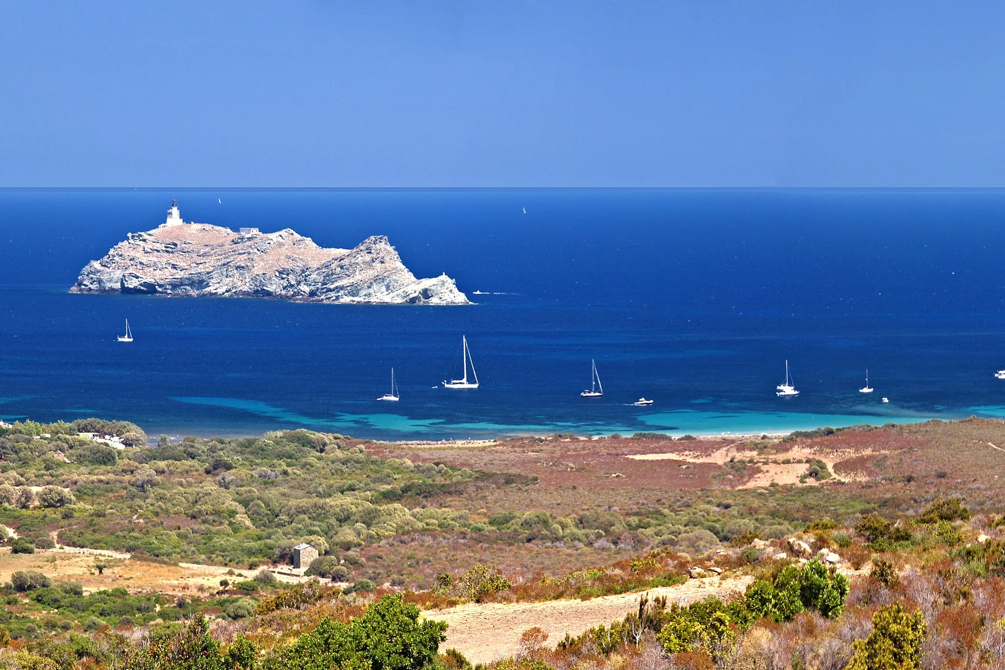
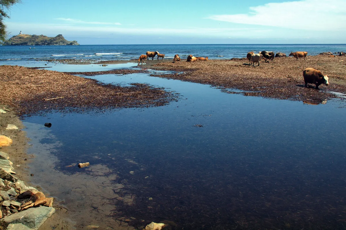
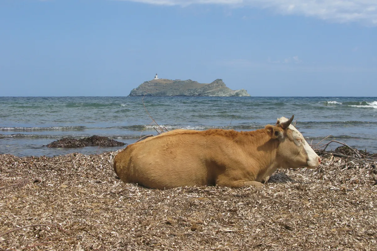
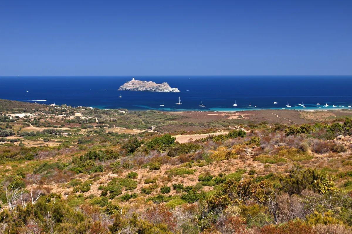
You will find nearly a kilometre of sand between the mouth of a stream and a lagoon, a high dune protected by the Conservatoire du littoral, the public body that protects the French coastline, and, a little over 2 km offshore, the island of Giraglia and its lighthouse. Cows often wander along the beach. It is also the end of the customs officers’ path from Macinaggio: you can walk out and come back by boat.
Type of beach: sand, water and swimming
It is a sandy beach (Cap Corse tourist office), often edged with banks of Posidonia. These heaps of dead leaves come from Posidonia seagrass meadows, a marine plant: they are natural and part of the beach.
The beach faces north-north-west, straight towards the Giraglia. It is open to wind and swell from the north and west: on those days, the sea can be rough and the water cooler near the shore. According to recent averages (2023-2025) from the Open-Meteo Marine dataset, the sea offshore is above 22 °C in June, reaches 26 °C in July and August and stays around 23 °C in September.
The tourist office lists supervised swimming only at Padulu beach, in Macinaggio: nothing is listed at Barcaggio. You swim at your own risk; stay close to the shore when there is a swell. In an emergency: 112, the European emergency number, from any phone; 15 for the SAMU (emergency medical service), 18 for the fire brigade, 196 for sea rescue.
The parts of the beach
To the west, right next to the car park, the Acqua Tignese flows into the sea. The sand is narrow here, often covered with Posidonia, and you often see cows lying on the leaves. The Conservatoire reports chaste trees at the river mouth.
In the centre, the curve of Cala beach proper widens in front of the dune. The beach restaurant is on this side.
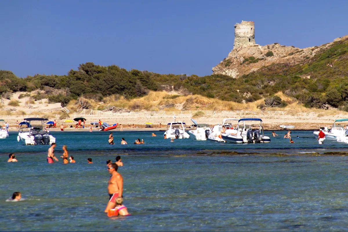
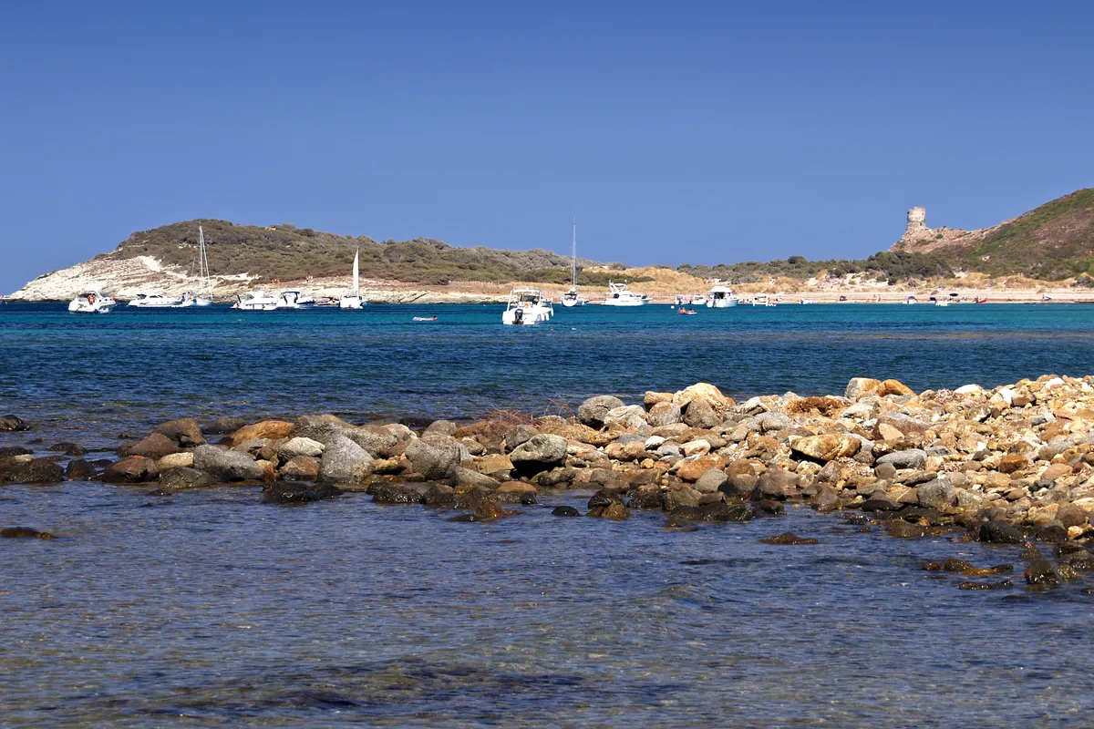
To the east, a lagoon closes off the beach. Beyond it the rocky coast begins, leading in about 900 m to Punta d’Agnellu and its tower. The coves of Cala Francese and Cala Genovese are separate beaches, about 3 km away as the crow flies, reached only on foot or by boat.
The Giraglia, the Agnellu tower and the dune
The Giraglia is the islet on the horizon, with a lighthouse and a Genoese tower. It is part of the réserve naturelle des Îles du Cap Corse, a nature reserve: landing is banned, so you look at it from the beach or from a boat.
The Genoese tower of Agnellu stands on the point east of the beach. The customs officers’ path passes at its foot: coming from Macinaggio, it is the last landmark before Barcaggio.
Behind the sand, the dune is covered with marram grass and then Phoenician junipers. Damaged by trampling, it has been restored by the Conservatoire du littoral: chestnut sand fences in front, a fence behind, marram grass replanted. Keep to the paths. Further on, a seasonal wetland and the lagoon are home to unusual plants, including Lippia nodiflora and Cressa cretica, according to the Conservatoire; the whole area is listed as the ZNIEFF “Zones humides de Barcaggio” (Barcaggio wetlands).
The beach and the dune lie within the Conservatoire’s “Pointe du Cap Corse” site, a listed landscape site and the Cap Corse nord et île Finocchiarola, Giraglia et Capense Natura 2000 site. The sea in front of them belongs to the Parc naturel marin du Cap Corse et de l’Agriate, a marine nature park. As on all Conservatoire land, fires, camping and motor vehicles are banned. If you come by boat, avoid anchoring on the seagrass meadows and check the maritime prefecture’s orders.
When to go
In June and September, the sea is already or still warm and the road is quieter. In July and August, set off early: the D253 is narrow and passing other cars is slow. The shuttle boat from Macinaggio runs from April to early October. For the path, choose a day without strong wind: the beach is calmer and the fire risk lower. Check the Météo-France forecast the day before.
How to get there
Barcaggio is at the end of the Cap Corse road. You get there by car, on foot along the customs officers’ path from Macinaggio, or by boat in season.
By car
From Bastia, allow about an hour (55 km), and from Macinaggio about half an hour (OSRM calculation, outside summer and without stops). Follow the D80, the Cap road, to above Ersa, then the D153 and D253 down to the hamlet. In places the D253 is only one lane wide: drive slowly.
Parking
There is a car park at the end of the road, at the entrance to the hamlet, beside the stream (Cap Corse tourist office). Parking arrangements may change from one season to the next: check with the Cap Corse tourist office.
From the car park to the sand
The western end of the beach is less than 500 m away, about 5 to 10 minutes on foot; the middle of the curve is a quarter of an hour away (OpenStreetMap walking route).
On foot from Macinaggio
The customs officers’ path (sentier des douaniers) starts from the beach north of the marina at Macinaggio. The Agence du tourisme de la Corse gives 3 hours to 3 hours 30 minutes to Barcaggio, on a path of moderate difficulty.
By boat
From April to early October, a shuttle boat links Macinaggio and Barcaggio in both directions, in about an hour. The timetable changes from month to month and booking is recommended: see the shuttle boat page.
Without a car
No bus goes as far as Barcaggio. A route links Bastia with Macinaggio; from there, take a taxi, the shuttle boat or the path. Bus routes and taxis on the Cap are listed by the tourist office.
Where the beach is
Good to know
Dogs
No official text sets a rule for dogs on this beach. Keep them on a lead, especially as cows wander on the sand, and check with the commune of Rogliano.
Wheelchair users
Barcaggio is not among the beaches equipped for people with reduced mobility listed by the Cap Corse tourist office. The way from the car park to the beach crosses soft sand.
With children
No official source describes how the seabed shelves or lists a lifeguard station. The beach is exposed to the wind: watch your children in the water and keep them away from the cows.
Naturism
No official text provides for naturism at Barcaggio.
Eating
A restaurant operates on the beach in season (Agence du tourisme de la Corse), and there are other places to eat at the hamlet’s harbour. Out of season, bring water and food.
The beach in pictures
Staying near the beach
The closest area to the beach in our Cap Corse guide: Macinaggio.
- Casa di Babbo 9.2/10 on Booking · Nov 2026Book
See 4 more places to stay Hide
We may earn a commission when you book through our partner links, at no extra cost to you.
Frequently asked questions
How do I get to Barcaggio beach by car?
On the D80, the Cap road, then the D153 and D253 from Ersa. Allow about an hour from Bastia and half an hour from Macinaggio (OSRM, outside summer and without stops). There is a car park at the end of the road, 5 to 10 minutes on foot from the sand.
How long does the customs officers’ path take from Macinaggio to Barcaggio?
The Agence du tourisme de la Corse gives 3 hours to 3 hours 30 minutes on foot, on a path of moderate difficulty that starts north of the marina at Macinaggio. Take water and do not set off in a strong wind, because of the fire risk. The path continues to Centuri.
Can I come back from Barcaggio by boat?
Yes, from April to early October: a shuttle boat links Barcaggio and Macinaggio in both directions, in about an hour. Timetable, fares and booking on the operator’s page.
Can you swim at Barcaggio?
Yes, it is a sandy beach. It faces north-west and catches the wind and swell from the north and west: on those days, the sea can be rough. The Cap Corse tourist office does not list any supervised swimming.
Are there cows on Barcaggio beach?
Often. The Cap Corse tourist office warns that you will come across them all along the beach and on the path, and points out that they are wild animals: keep your distance, do not feed them and keep an eye on children and dogs.