Corsica travel guide
Hiking

Lac de Nino

A mountain lake at 1,743 m, ringed by wet grasslands where horses and cows graze, on the GR20 and a long half-day’s walk from the Valdu Niellu forest.

Altitude
1,743 m
Ascent
730 m from Popaghja
Level
Difficult
Overview

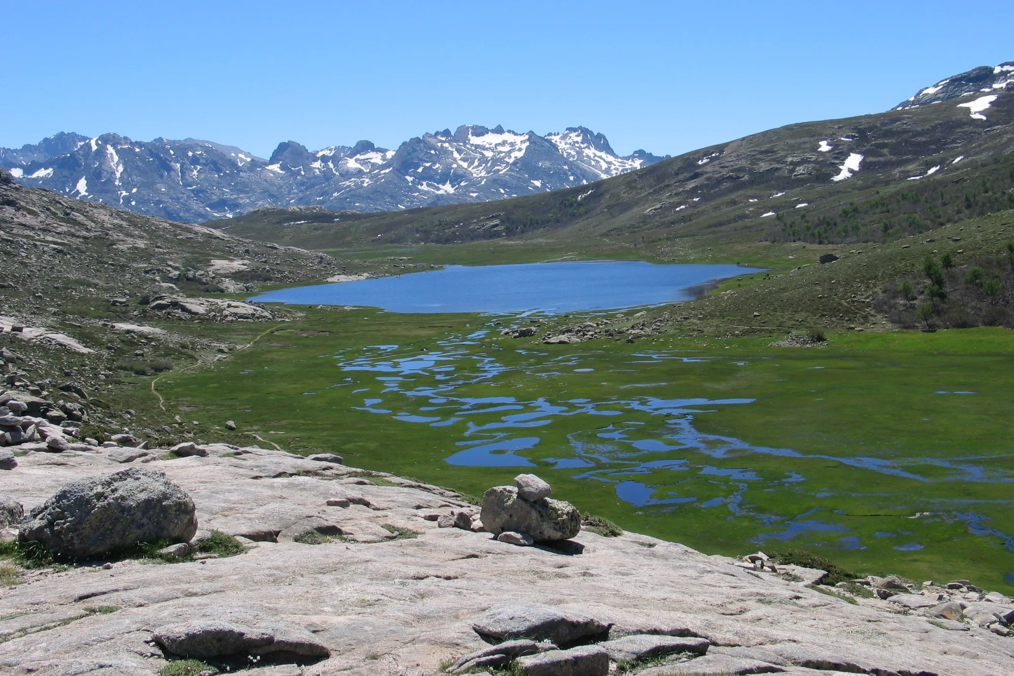
Lac de Nino (Lake Nino) is a mountain lake at an altitude of 1,743 m, on the Camputile plateau, above the Niolu. This is where the Tavignano, the river of Corte, rises. At 6.5 ha, it is the second largest lake in Corsica, after Lake Rotondo, according to the Parc naturel régional de Corse (Corsica’s regional nature park) and the Agence du tourisme de la Corse.

The lake is surrounded by short grassland dotted with small pools, where horses, cows and pigs graze freely in summer. The GR20 passes along its shore, and the lake is very busy in summer, according to the Agence du tourisme de la Corse.

The pozzines

Around the lake lie the pozzines: grassy meadows with short turf, scattered with water holes of varying depth, fed by water seeping from the peat bog. These wetlands are fragile: the park bans walking poles at Lac de Nino and asks visitors not to trample them. Stay on the path, even when it makes a detour.

There are pozzines on other plateaus of the island too, such as the Coscione plateau. Our page on Corsican flora describes the plants that grow there.

Why go

For the hike itself and for the arrival: after the climb, the lake opens up all at once below the Bocca à Stazzona or the Bocca a Reta, with its meandering water and green grassland among the ridges. People come for the day, bringing a picnic. Swimming is banned, as in all the park’s high-altitude lakes.

The shortest path starts from the Popaghja forest lodge, in the Valdu Niellu forest. It is rated difficult: the climb is steep, and you have to get through a gully using your hands. The GR20, from Castel di Verghju, is much longer, on a stage the park describes as ‘easy going’.

The lake and the GR20

The lake is on the GR20 stage from the Ciottulu di i Mori refuge to the Manganu refuge, stage 6 according to the park. The Manganu refuge is about 6.8 km from the lake along the trail, according to OpenStreetMap. To sleep near the lake, you therefore need to book a night at the refuge with the park: bivouacking is only allowed around the refuges. Our page on the GR20 describes the sixteen stages, and our page on the lakes of Corsica covers the island’s other mountain lakes.

Updated 2 November 2026

Getting there

How do you get to Lac de Nino?

By car

The Popaghja forest lodge, in the Valdu Niellu forest, is about 45 minutes from Corte, via the Scala di Santa Regina and Calacuccia, outside summer and without stopping (OSRM calculation). Park in the forest lodge car park. Castel di Verghju, on the same road towards the Vergio pass, is about an hour from Corte, and the pass about 45 minutes from Porto.

On foot

The lake is on the GR20, between the Ciottulu di i Mori and Manganu refuges. See our page on the GR20.

Hikes

The paths

Two starting points lead to the lake. The first is a short hiking route described by the Agence du tourisme de la Corse (the Corsican tourist board), the second follows the *GR20*.

From the Popaghja forest lodge

Distance
About 4 km each way
Elevation
730 m of ascent
Time
4 to 6 hrs return
Level
Difficult

The path, waymarked in yellow, crosses the pine forest and then climbs the Colga valley to the shepherd’s hut, after about an hour. The slope then steepens through scree and slabs, with a gully to climb using your hands, up to the Bocca à Stazzona (1,762 m), where the lake comes into view. More scree comes before the descent to the shore.

Source:

Agence du tourisme de la Corse, ‘Lac de Ninu’ route; walking time: ‘Top 10 des randonnées à faire en famille’

Along the GR20 from Castel di Verghju

Distance
About 9.7 km each way (OpenStreetMap measurement)
Elevation
About 480 m of ascent to the Bocca a Reta, then 140 m of descent to the lake
Time
About 3.5 hrs each way (calculated estimate)

The GR20, waymarked in red and white, follows a path through laricio pine forest to the San Petru chapel, then climbs gradually to the Bocca a Reta (1,883 m), where you can see the lake. No official guide gives the time for this route. Based on its distance and climb, allow about 3.5 hrs each way, and a long day for the return trip; you can also walk it as part of a GR20 stage.

Source:

Parc naturel régional de Corse, GR20 page; distance and altitudes: OpenStreetMap; time: calculated from distance and climb (DIN 33466 rule)

Rules

A protected site

Pozzines

Walking poles are banned at Lac de Nino, and you must not trample the pozzines: they are fragile wetlands, according to the rules of the Parc naturel régional de Corse (Corsica’s regional nature park) for the GR20.

Swimming

Swimming is banned in high-altitude lakes, under the same park rules.

Bivouacking

Wild camping is banned. You may only pitch a tent near the GR20 refuges or in the designated areas, and the night must be booked with the park.

Dogs and animals

Dogs must be kept on a lead. Horses, cows and pigs graze freely around the lake in summer: do not feed them.

Fire

From 15 June to 30 September, lighting fires and smoking are banned in forests and the mountains. On days of very severe risk, the prefecture can close access to the massifs: check the fire risk map the evening before.

Protection

The lake lies within the Parc naturel régional de Corse and the massif du Rotondo Natura 2000 site. Its basin and its pozzines form a natural area of ecological, faunal and floristic interest (ZNIEFF). Flying a drone requires authorisation.

Safety

Safety and precautions

1

Set off early

Storms often break in the afternoon in the mountains. Start early, take water, a windproof and warm clothing, and turn back if the weather deteriorates.

2

The gully

Below the Bocca à Stazzona, you need to use your hands, then cross scree. Mountain boots are essential, and children need to be in good physical condition, according to the Agence du tourisme de la Corse.

3

No signal

The phone network is unreliable in this area. Tell someone your route before you set off. In an emergency, call 112, the European emergency number, from any phone; 15 for the SAMU (emergency medical service), 18 for the fire brigade, 196 for sea rescue.

4

Snow

In spring, snow may still cover the path and the passes. Check the Météo-France mountain forecast before you set off.

Find your bearings

Where it is